Northwest Territories - Puppy Packrafting
Full disclosure, I wrote this post soon after completing this trip. Then, two months after we had returned home, our puppy, who accompanied Malcolm and I on this awesome adventure, was hit by a car and killed. I initially thought I would not be able to post this, but looking back through the photographs and rereading what I wrote about our time in the Canadian wilderness made me so happy. It also made me incredibly teary-eyed and sad. I decided to publish this as I first wrote it, without any embellishment or extra sentiment. We were hoping to go on so many more adventures with our pup Squirrel. But in the end, the month that we all had together in Canada will have to be enough. I hope you enjoy and then go give your best four-legged friend some tummy rubs.

Two years ago, my partner Malcolm, and I started talking about doing a big trip together. I guide professionally in the summer, which keeps me extremely busy from May through September. Malcolm works in the environmental consulting world in addition to periodic guiding stints, so he too has difficulty finding the time for personal adventures in the summer. But last fall we made it a priority and told our respective employers that we would be gone the entire month of July in 2016. Now there was just one question: where would we go?
Initially we had planned on doing a trip in Alaska's Brooks Range. We have both spent a fair amount of time exploring the Brooks, but there is so much more to see. Plus, the Brooks Range is within a day or two of travel from our home in Anchorage and logistics are relatively easy. But as we explored trip options, it dawned on us that it might be more fun to explore somewhere totally new together.
Then, in midwinter I saw a picture taken by outdoor, adventure photographer Colin Field. He had been commissioned by the newly formed Nááts’ihch’oh National Park Reserve to travel down the Broken Skull River in the eastern portion of the park with local outfitters and park personnel. His pictures were gorgeous. I found Nááts’ihch’oh on a map and was delighted to see that it was smack dab in the middle of nowhere in Canada's Northwest Territories. Best of all, by everyone's best estimate, the National Park group that traveled down the Broken Skull in June of 2015, was only the third party to ever canoe this river. The Broken Skull was my type of destination: remote, wild and practically untouched by humans.
Malcolm and I started to explore route options and eventually settled on walking in from the remote North Canol Road in the Yukon. We would travel roughly 100 miles over land, through the alpine of the Mackenzie Mountains, crossing the upper Peele and Natla Rivers, eventually reaching the headwaters of the Broken Skull. Then we would float the Broken Skull to its confluence with the Nahanni River - a popular and frequently canoed river in Nahanni National Park Reserve. From there we would continue down the Nahanni, stopping to make a detour up to the Cirque of the Unclimables - world famous for its granite walls and outstanding rock climbing. The trip would conclude with a take out via float plane at Virginia Falls - the tallest waterfall in North America (twice the height of Niagara!) on the Nahanni River. We planned to take 25 days to complete the trip.
Before the plan could fully come together, there were two other items to figure out. One, we had adopted a husky-mutt puppy in March. At the time of the trip she would be five months old. Neither of us were too keen on leaving her with friends and family for a whole month. But could our pup, Squirrel, complete the trip? Could we carry 25 days of dog food in additional to our gear and human food? We decided to try.
The other item was getting to our put-in. The North Canol Road runs northeast from the remote village of Ross River in eastern Yukon. It would be 5 hours of driving over rough track from Ross River up the Canol Road to our starting point. And then what? Would we leave our truck? How would we get back to it at the conclusion of the trip? Our Plan A was leave a bike in Ross River, park the truck at the put-in, following our pick up we would hitch hike to Ross River, then bike the 145 miles to return to our truck. A week before we were scheduled to depart it occurred to us that Plan A was an especially stupid plan. Through friends of friends of friends and the magic of the internet, we found a guy in Whitehorse, Yukon who, for the right price, would accompany us up the North Canol Road and return our truck to Whitehorse. We made the arrangements, packed up and headed to Canada.

Our trusty Toyota Tacoma who got us up the North Canol Road, our adventure pup, Squirrel, and us, smiling and clean at the start of our trip.
As we puttered up the North Canol Road at 20 mph we were all struck by how beautiful this country was and how remote. I've traveled a lot of back roads from Mexico to China to Argentina and none seemed as "out there" as the North Canol. It was constructed during WWII as part of an oil pipeline project from Norman Wells, Northwest Territories to Whitehorse, Yukon. The pipeline is long gone, but parts of the road remain. The Yukon maintains the South Canol (Johnson's Crossing to Ross River) and a portion of the North Canol (Ross River to MacMillan Pass). At MacMillan pass, the road reaches its high point and the Yukon-Northwest Territories border. From there the road becomes even more rough and eventually disappears all together. In our 5-hour, one-way journey, we didn't see another vehicle, apart from the graveyard of WWII-era work trucks parked near Mac Pass (as it is referred to by the locals). We stopped at the Mac-Pass airstrip around 9pm and started walking up a seemingly seldom used mining access road - suddenly our trip had begun.
The excitement of finally being on the move made us both oblivious to our collective 170 pounds of pack weight. We hiked until nearly midnight, before topping out on a ridgeline in the twilight. We pitched the tent, basked in the beautiful sunset light and caved and let the puppy into the tent; we had vowed she would sleep outside but after 10 minutes of watching her get massacred by mosquitos we turned into big softies and had her cuddling next to our feet that night, and every night following.


The next day dawned sunny and clear. Our over-loaded packs made their presence known as we went up and over three alpine passes that first day. By the time we made camp for the night we were exhausted and already behind schedule. We looked at the map and realized that our ambitious plan of walking 100-ish miles in six, maybe seven days was not going to happen. At our current pace it was looking more like a 10-12 day hike. Which might mean we would have to adjust our plans while on the river. The only thing to do was to keep walking.


Fortunately our pace did improve as we continued to travel eastward. Our packs became marginally lighter and the terrain evolved from steep rocky alpine to more undulatory, softer mountains. As we approached the Natla River on our seventh day we bushwacked through head-high dwarf (is it still dwarf if it is six feet tall?) birch. We approached the Natla from an elevated bench and looked down on the beautiful turquoise-hued river. We had been unsure of the crossing, knowing that the Natla has several sections of rowdy rapids. But below us was a beautiful stretch of flat water between two sets of rapids, with an easy descent and an easy exit from the river valley. Just then we noticed to our right and upriver, there were people! In seven days we had seen zero sign of humans, not a footprint, not a piece of trash and here there were six flesh and blood humans eating lunch on a gravel bar.
We descended down to meet them. Squirrel was so ecstatic to see other people again. Malcolm and I were beginning to speculate that maybe she thought this was her new life - walking forever with just Malcolm and I, tired and hungry and never seeing another soul. The group was a guided group from Black Feather, it looks like they do a lot of really spectacular trips in Northwest Canada! The guides were rather incredulous to see us - the Natla is a seldom run river, this particular company only runs it every other year or so, and they had never heard of anyone walking in the way we had to access the Broken Skull. Undoubtably they had told their clients to expect to see no other humans while on the river. We hoped that we did not ruin their wilderness experience, but were immensely grateful for the fresh produce they shared with us on the gravel bar!

Malcolm getting ready to cross the Natla River.
After we crossed the Natla, we ascended our last pass to access the headwaters of the Broken Skull. We camped on the edge of a beautiful lake, full of bird life - loons, surf scoters, mergansers, various shorebirds. The following day we began our descent along the upper, upper Broken Skull. Just like that we had made it to the river, and only a couple of days behind schedule. The walking portion of our trip had rewarded us with great wildlife - birds, moose, caribou and a grizzly bear a bit too close for comfort. We also enjoyed incredible tundra walking, mild brush, perpetually soggy feet, steep passes and incredible vistas. Now it was time for the river.


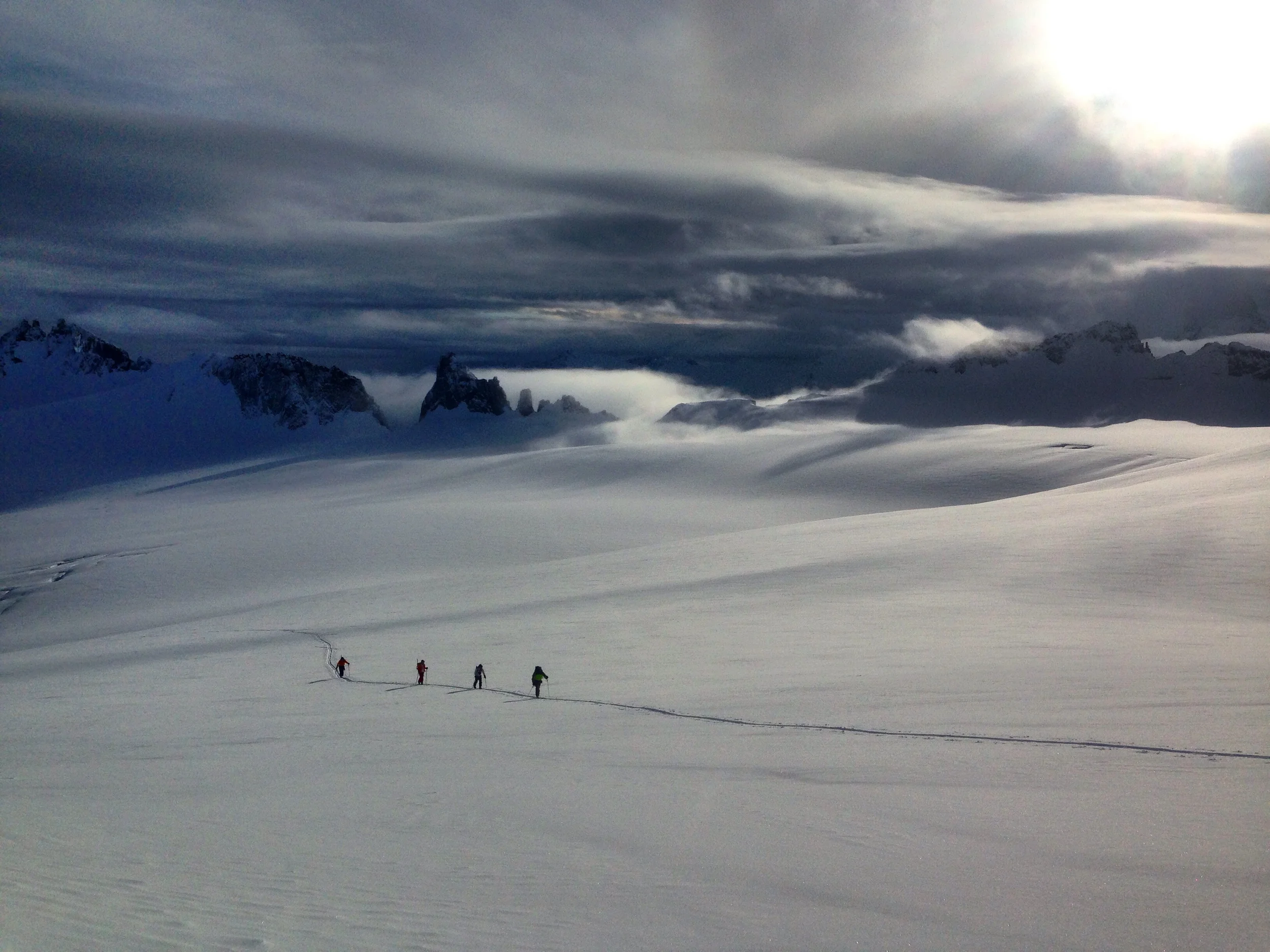
The Broken Skull begins as a series of marshy bogs before it coalesces into, at first, a small creek, and eventually a floatable river. As we continued walking downriver Malcolm and I were both eager to begin floating. We were constantly gauging whether or not we thought there was enough water to float or if we thought we might get stuck dragging boats. In the end it was good we waited. As we came around one last corner, the Broken Skull plunged into a quarter mile long canyon of class V+ rapids, 5-15 foot drops and sluice boxes. Maybe this was the section that earned the river its name?

The Upper Broken Skull canyon - slightly above my current paddling ability!
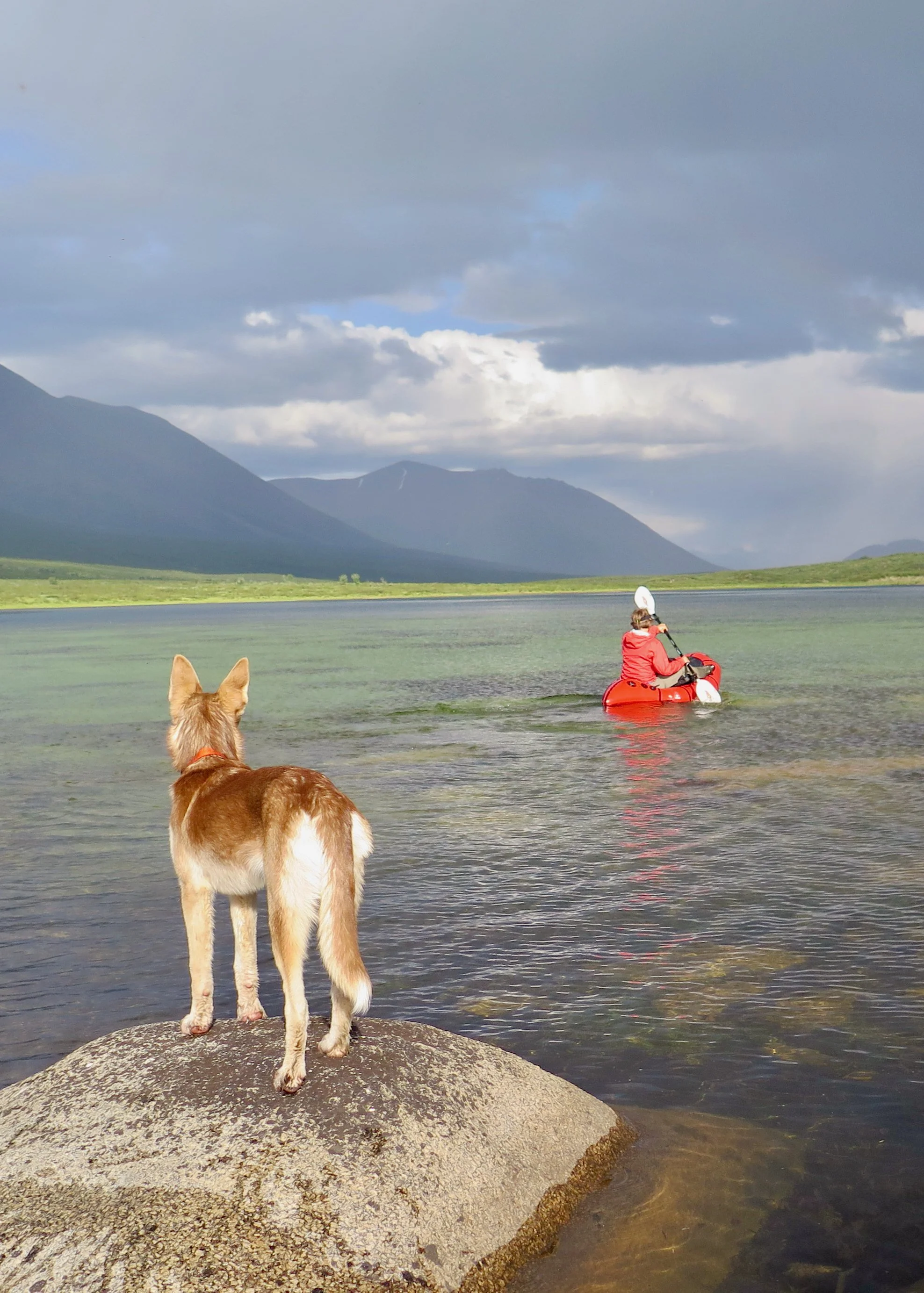
We put our boats together just below the canyon on a sunny gravel bar in the early afternoon. The first part of our trip was over and we were ready for the next challenge. Most of all we were curious to see how Squirrel-pup would do. She had only been on moving water once, and then only for about a mile. A month ago she had been terrified of puddles and absolutely refused to get her feet wet. Needless to say, we were a bit apprehensive about what 200 miles of boating might be like.
Squirrel traveled in Malcolm's boat - he has a bigger cockpit and is a better paddler than I. Having the dog in the boat meant that he couldn't wear a whitewater spray skirt to keep water out of the cockpit. So, I ran everything first, looking for the least splashy line for Malcolm and Squirrel to follow, keeping an eye out for undercuts and wood hazards. Within the first 5 minutes, Squirrel made a break for it and jumped out of the boat. She swam a rapid and made her way for the shore as quick as her little, inefficient, husky doggie-paddle would take her. She had quickly realized that out of the boat was a lot less dry than inside the boat. We came ashore, reorganized and set out again. For the next 6 hours Squirrel stayed in the boat but made her displeasure known by sharing with us lots of plaintive husky noises. Malcolm and I did our best to ignore her pathetic whines and enjoyed the heck out of the paddling. The Broken Skull was everything we had hoped it would be - continuous, splashy, class II+ fun!


We paddled late into the evening on our first day to make it to a particular creek we wanted to camp along. Rumor (and GPS coordinates) had it that there was a natural hot spring a few miles up the creek. With mild bushwacking and one very close call with a surprised grizzly bear we made it to the springs and spent the evening soaking in this perfect, natural pool.

Malcolm and Squirrel on the edge of a the most perfect natural hot springs I have ever seen! All to ourselves, except for the Grizzly Bear nearby!
The following two days we were back on the river, enjoying all of the splashy fun the Broken Skull had to offer. We traveled through tight mini-canyons, braided sections and large mountainous valleys. We loved every second of our time on the Broken Skull. Even though we have both floated many rivers in Alaska, Malcolm and I both agreed that this was the most beautiful and fun stretch of river we had ever been on! We were almost disappointed when we arrived at the river's confluence with the Nahanni River.
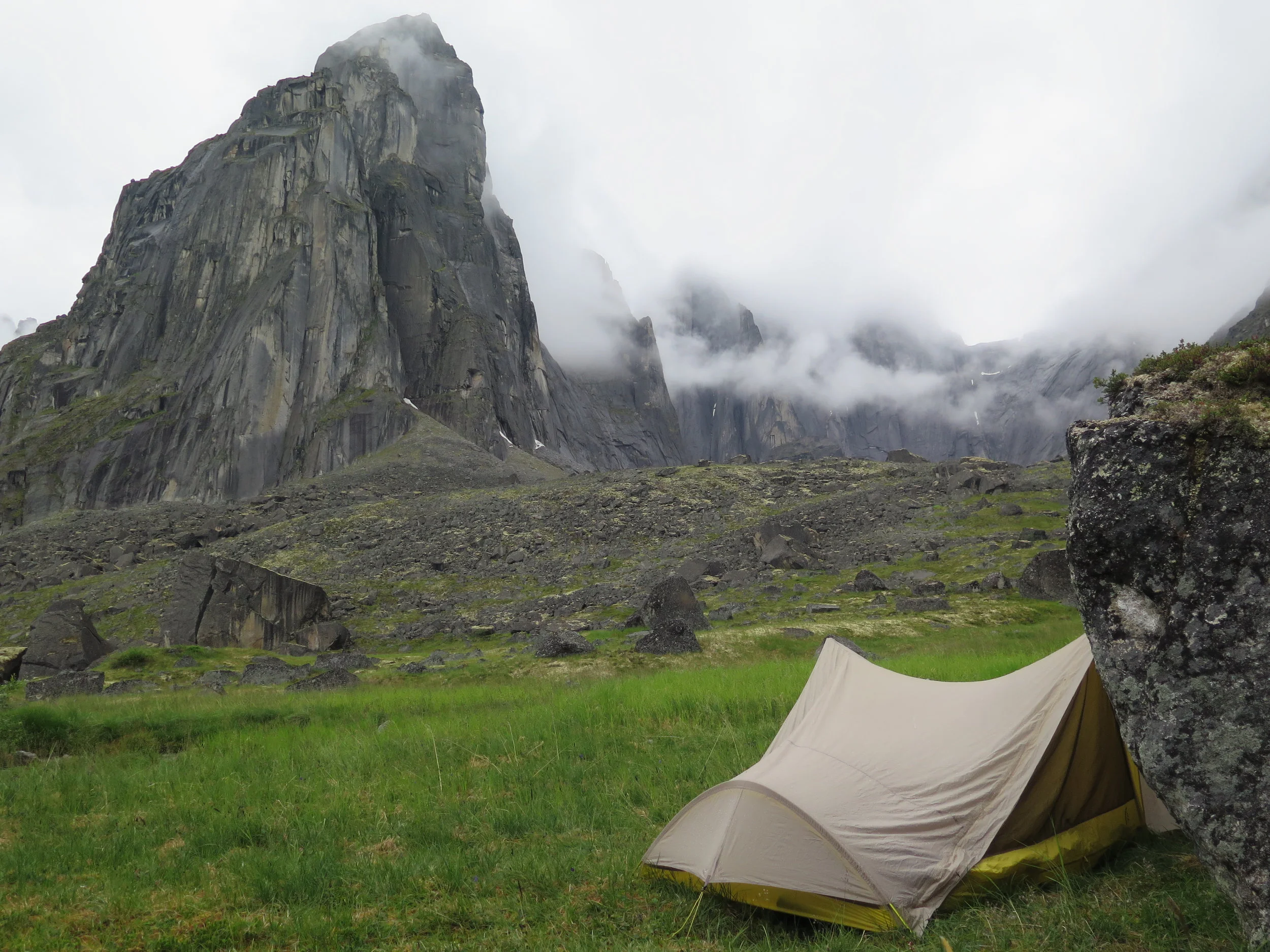
But there were more beautiful things to see along the Nahanni. We hiked from the river up to Glacier Lake and from there we paddled across to the National Park cabin at the west end of the lake and the access trail to the Cirque of the Unclimbables. We went to the Cirque to hike around and enjoy the scenery, but most folks are there climb. The most famous of the climbs is the Lotus Flower Tower and one look at it tells why people travel such a long way for that one climb. I really can't image a more spectacular place. We ran into three parties of climbers up there. Most get dropped off at Glacier Lake via float plane, but some float the Nahanni down and hike up to the Cirque. Squirrel was beyond ecstatic to meet new people and beg for peanut butter from the dirtbag climbers.


After a few days around the Cirque and Glacier lake we returned to the river and our cached boats. We paddled two long days down the Nahanni River, spending 10 and 12 hours on the water, fighting the slow current and a strong headwind. On our 20th day out, we made a muddy, soggy camp on a small gravel bar late in the evening. We knew we were close to the take out, but after 12 hours of soaking wet paddling, we were ready to eat some warm food and get some sleep.
Our final day of paddling dawned drizzly and damp, but we knew we had a short stretch of river ahead of us. Before we knew it we rounded the bend of the Nahanni and caught sight of the docks and infrastructure of Virginia Falls. We were there! The weather cleared and we spent the afternoon drying out our gear and hiking around the incredibly impressive waterfall.
Lucky for us, the adventure was not over quite yet. The next morning, Squirrel got to experience her first small aircraft flight. She did great, but I am not sure she would willingly get into an airplane again. And then all three of us got to enjoy the novelty of hitch-hiking from Watson Lake to Whitehorse, Yukon - there is a story there for another time. 21-days (ahead of schedule after all!) from when we had set off on the North Canol Road to start our trip, we were reunited with our truck and started a leisurely journey home.


In the end, the trip really felt segmented. The first half, the hike in and the 3 days on the Broken Skull felt remote, wild, at times challenging and totally unexplored. Apart from our incredibly unlikely meeting with the paddlers on the Natla River, it really felt like it was just us three out there for hundreds of miles around. Once we connected with the Nahanni River and spent time at the Cirque and Virginia Falls, the infrastructure and signs of humans made for a much less exploratory feeling, though the scenery was no less beautiful.


In truth our first 11 days really made the trip. I would recommend the Broken Skull to anyone and I would even recommend the walk in despite the distance, our chronically wet feet and more dwarf birch bushwacking than is ideal. Personally I'm stoked to have seen just a bit of what Yukon and Northwest Territories has to offer for wilderness trips - I think we will be back.
In the end, the trip went off without a hitch. The complicated logistics and unknowns along the first half of the route all just worked out. My biggest takeaway, beyond the beauty of NWT, was a sense of accomplishment at getting Squirrel through the trip without too much physical or emotional suffering on her part. It looks like Malcolm and I have a pretty great adventure buddy on our hands!

On the final day of our trip - Malcolm, Squirrel and I at Virginia Falls.