Ladies Trip - Arctic National Wildlife Refuge - August 2017
TOTAL MILES: 216 - 120 miles on the Atigun, Wind, Junjik and East Fork of the Chandalar Rivers; 53 miles backpacking Atigun to the Wind; 43 miles backpacking Wind to Junjik

Refuge:
We need wilderness whether or not we ever set foot in it. We need a refuge even though we may never need to set foot in it. - Edward Abbey
A TRIP IS BORN. Last February, I saw a picture of the Wind River, not the famous Wind of Wyoming, but a smaller river snaking between limestone peaks on the south side of the Brooks Range in Alaska’s Arctic National Wildlife Refuge. I wanted to go there and started thinking about the best way to access it.
I frequently fly in small aircraft for work. While I have nothing but admiration for aviation in Alaska, I worry about the carbon footprint of consuming so much avgas. And, for me, sometimes flying in and out of trips can feel like cheating. My preference for this trip was no chartered airplanes, instead utilizing access to the Arctic Refuge via the Dalton Highway, commercial airports or villages with daily airmail service. This qualification helped to narrow down the infinite route options in the Arctic Refuge.
In an effort to cultivate more trip partners, especially women, I emailed some cool Anchorage ladies and invited anyone who had the time off, and an interest in traveling through the Arctic Refuge, to join me. Annie was instantly on board and Mollie committed soon after, making us a crew of three.
The plan we settled on was to paddle, hike, paddle, hike, paddle, linking up three rivers: the Atigun, the Wind and the Junjik with short backpacking routes between each. We gave ourselves 14 days in late-August, hoping to maximize our time spent among the fall colors, but before the serious snow came to stay.

Our route from the Dalton Highway to Arctic Village across the southwest quadrant of ANWR.
SCIENTIST. PHOTOGRAPHER. GUIDE. In classic Alaska fashion, we are a multi-faceted group of women. Of the three of us, Annie probably has the most traditional career. She manages the Stable Isotope Lab at the University of Alaska Anchorage, but she also makes art, bakes, gardens and take photographs. Mollie always has a camera in her hand, so I think of her foremost as a photographer. But she also makes a living by editing other photographers’ work, substitute teaching, guiding photo tours and recently, by writing and editing the rerelease of Hiking Alaska. I usually introduce myself as a guide, but in addition to guiding and management at a guide company, I occasionally earn money from freelance accounting, writing and photography.


GETTING THERE. The three of us flew commercial to Deadhorse, Alaska. The oil fields of Prudhoe Bay, just north of Deadhorse, have powered the Alaskan economy since the mid-60s. But as the reserves diminish and the state of Alaska grapples with the fact that it is financially dependent on a single, volatile industry, the state and the oil companies look east to the Arctic Refuge and the oil beneath its coastal plain. Starting a trip to ANWR with a stop in Deadhorse is a good reminder of what is at stake in our nation’s largest Wildlife Refuge.

The oil pipeline that runs south from Prudhoe Bay to Valdez, AK.
Our ride south was chauffeured by a salty Deadhorse resident (one of three he claimed!) named Gil, who liked to utter things like “Scientists. I don’t know what the fuck they’re doing. It’s important, but I don’t know what the fuck it is”. I kept a running list of Gil-isms as we drove south for 5 hours. He dropped us at the Atigun River and turned back north in a cloud of cigarette smoke.

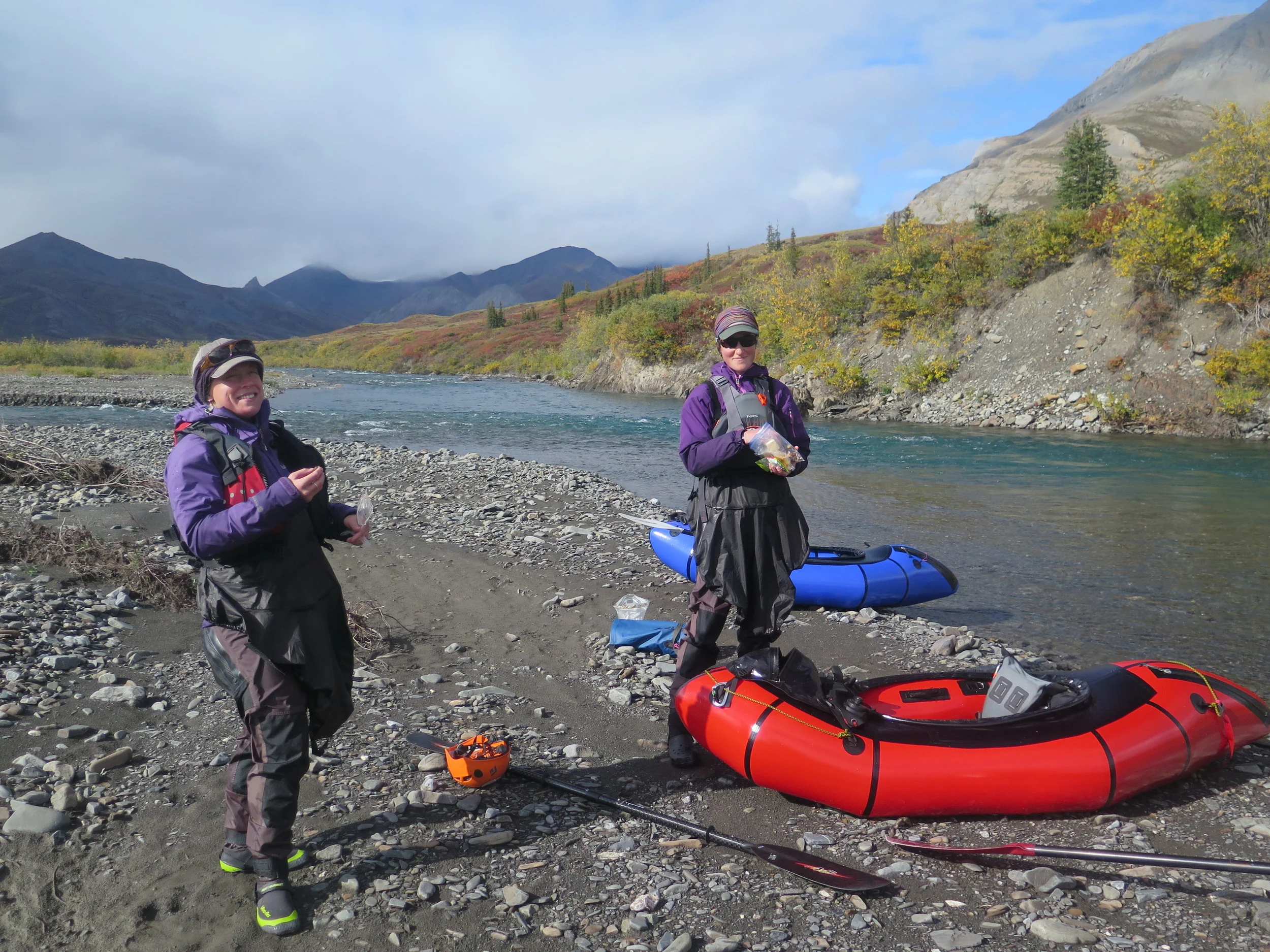
Stopping for scenic snacks and yet another scouting mission along the Atigun River.
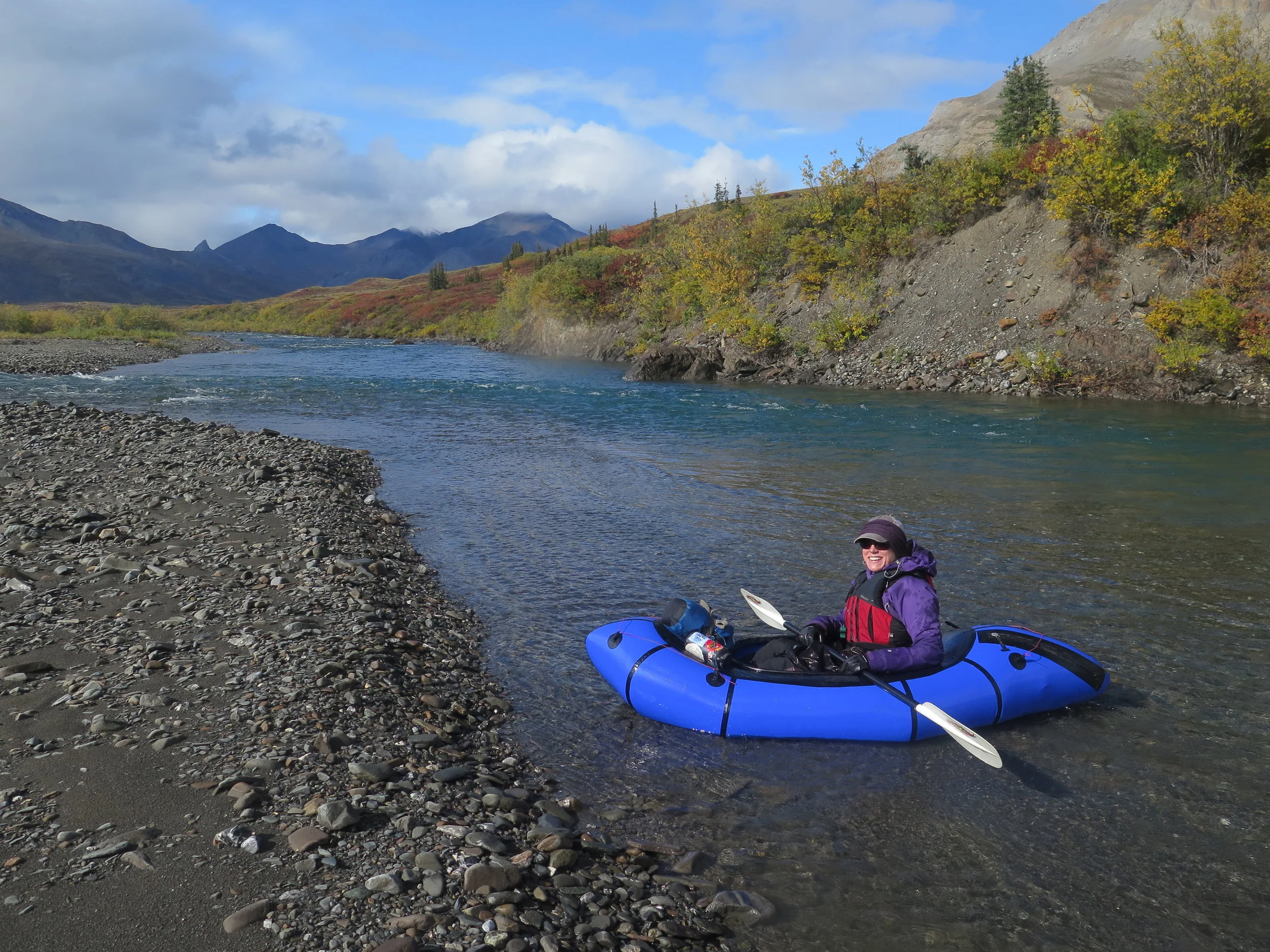
THE ATIGUN RIVER. When we arrived at the Atigun River, it looked high. Unfortunately, the three rivers we paddled during the trip began with the most challenging and diminished in difficulty. It would have been nice to work our way up to the Atigun – Annie and Mollie had yet to paddle their Packrafts fully loaded and I hadn’t paddled much this summer. After the first extended set of whitewater, we pulled over. Mollie reminded us it might be good to talk about safety and signals, something we had overlooked in our excitement that morning. We all expressed at least mild concern about the water level and our paddling confidence. Of the 12-mile long section of the Atigun River, we walked and scouted close to 6 miles. The scouting allowed us to paddle the entire river with proficiency, if not style, fully portaging only the biggest set of rapids before enjoying the final, splashy section as the Atigun came to join the Saganavirtok River.
ATIGUN TO WIND. It took four days for us to travel from the Saganavirtok River to the Wind. The first two days treated us to varied terrain - marsh, tussocks, quintessential Brooks Range tundra. I joke that the Brooks Range is the only desert you can walk through with wet feet and these days certainly proved that to be true. There were low clouds, but little rain and we were treated to a lot of classic Arctic vistas – dappled sunlight playing on broad valleys and upswept limestone peaks. The third and fourth days we traveled through upper Accomplishment Creek and the headwaters of the Wind River. The terrain grew more alpine with talus, scree and dry tundra – my kind of walking. I prefer the higher elevation, more intricate route finding of the Brooks Range’s narrow drainages, to the continuous plod of moving up long valleys. I would have loved to play in the upper portions of these two drainages for a week but we had miles to make and uncertainty ahead of us.

Where's Mollie? Climbing talus piles at the headwaters of Accomplishment Creek. One of my favorite landscapes of the trip!
THE WIND RIVER. The Wind River is what brought me back to the Arctic Refuge this year. By the time we got to the Wind we had enjoyed four days without rain, so water levels were low meaning the wave trains and rock gardens I had heard about while doing trip research were nearly inconsequential, especially after our experience in Atigun Gorge. While the Wind wasn’t as exciting as I would have hoped (we started calling it the Wind (rhymes with find) by the end of our second day) it offered up spectacular scenery – well-lit limestone peaks, fall colors and one rainbow after the next. Our group’s tree nerd – Annie – was excited to paddle past the northernmost White Spruce growing along the river. She had done her masters research on this species at a field site downriver. As it approaches Keche Mountain, the Wind spreads out into a “lake”. We considered dragging boats through the lake and continuing downriver but this feature is just west of Annie’s field site. Enticed by good camping – Annie promised dry tundra, nice views and a freshwater stream – we ended our time on the Wind.
Mollie paddling the Wind River past the limestone peaks of the Brooks Range.
Wind to Junjik. I was not optimistic about the walking between the Wind and Junjik Rivers. We assumed the first day would be the worst, we had to travel through Spruce forest to get to Smoke Creek, which was green (i.e. vegetated) on the map and low elevation. We planned to go over another pass as soon as possible, into a smaller drainage that was slightly higher. As it turned out, the Spruce forest was some of our best walking with patches of dry white lichen between the trees. We descended into Smoke Creek to find several beautiful, shale, alluvial fans connected by caribou trails. We marveled at our luck as we made fast miles. But the luck ran out in the next drainage. What we though would be better walking turned into a full day of ankle-twisting tussocks and then crashing through dense willows along a creek. Our final day approaching the Junjik surprised us again – a higher elevation pass was obnoxiously squishy and a connecting stream we thought could be terribly vegetated was paralleled by a well-established moose trail. Low clouds and rain had followed us for three days as we hiked. I would have loved to see some of the higher peaks, but we hoped increased rainwater in the system would help us out on our final river.

Some trips to the refuge you see thousands of caribou. Some trips you see only one. But everywhere you look, you see evidence of them.
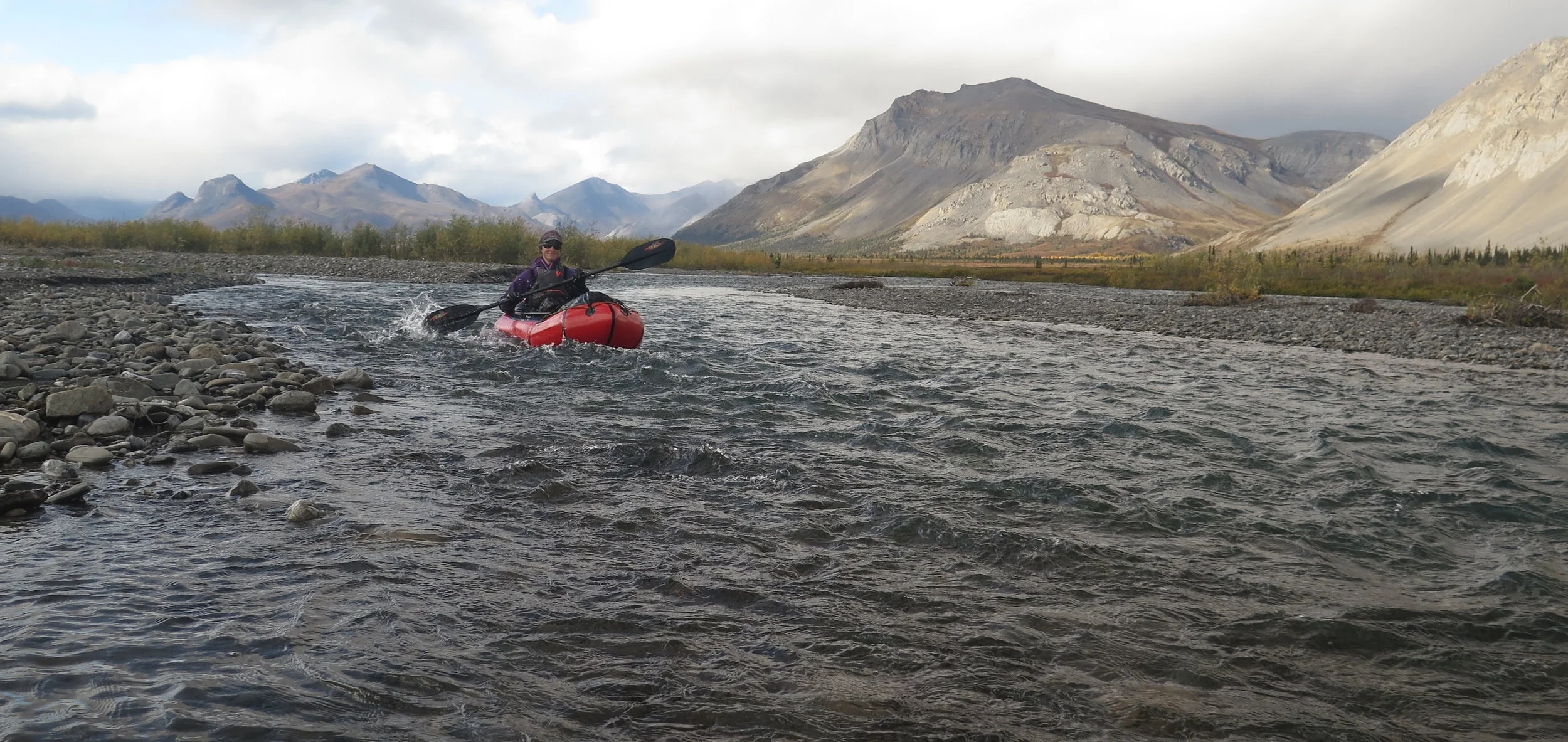
THE JUNJIK RIVER. Friends who had paddled this river in June advised that it was slow and boring. They paddled 24 hours in two days, making the most of June’s constant daylight. Based on their report, and with late-August’s shorter days, we budgeted three days to float the Junjik to its confluence with the East Fork of the Chandalar River and then on to Arctic Village, dreading the tedium ahead of us. But when we reached the shore of the Junjik, it was swollen and rising.
The first day on the Junjik was sheer fun, despite the continued rain. As we were pelted with the largest raindrops I have ever seen in the arctic, our little group cheered “Every raindrop counts!” grateful for the additional water. The added volume gave us mini wave trains, and fun, fast water when we had been expecting ass-dragging gravel bars and mind-numbing paddling. The water wasn’t the only joy of the day, in the afternoon a dark grey wolf trotted towards the river, bounded through the shallows and swam across the entire river – tail out like a rudder.

Paddling in the sunshine, past golden-hued trees along the Junjik River.
Our final travel day, the Junjik and then the East Fork of the Chandalar were running turbid and fast. We lounged in our packrafts enjoying the most brilliant sunshine of the trip as the runoff from the proceeding storm propelled us towards our final takeout. All told it took us 17 hours, over two days, to paddle from our put-in on the Junjik to boat launch in Arctic Village. After all of our trepidation, this river provided some of the best paddling, great wildlife viewing and the most beautiful weather day of the trip.

Drying gear in Arctic Village - before the snowstorm.
ARCTIC VILLAGE. Our reception in Arctic Village was incredibly warm. We chatted with various locals, the village patriarch/minister and the ladies at the tribal office. As we set up camp near the airstrip, multiple people seemed incredulous that we would be camping, even after we explained that we had been out for two weeks. Before we went to bed a woman ATV-ed up to check on us and see if we wanted to sleep inside. We were grateful, but happy where we were, so instead we made plans to have coffee together in the morning. As it turns out, the locals knew something we didn’t – we woke up to the first blizzard of the season. Our afternoon flight home wasn’t looking too likely. While still snuggled in our sleeping bags, I heard a plane’s engine and went to chat with the pilot. He had just landed and was headed to back to Fairbanks. He had room, but he was leaving in three minutes whether or not we were on the plane – he was worried about icing and visibility. I ran back to the tent, rallied Annie and Mollie and we gathered the whole tent, sleeping bags and all into a soggy, snowy purse. We threw it in the nose of the plane and took off for Fairbanks. I still feel bad for bailing on our coffee date, but I’m glad we made it out before winter settled in.

Arctic Village - situated in a beautiful place - faces similar issues to other AK bush communities, like what do you do with old appliances when it costs up to $1.00/lb to fly freight out of town?
FINAL THOUGHTS. Long walks give a person lots of time to think. During this trip, I spent a lot of mental energy on comparisons. The north side of the Brooks Range vs. the south side – I still prefer the north side. June trips vs. August trips – August’s colors are just barely more appealing than June’s sunshine and wildflowers. Ladies trips vs. mixed-gender trips – when its just girls everybody pees together and the conversation doesn’t stop, what's not to love? But the biggest comparison I kept coming back to over and over again was guided work trips vs. personal trips.

The Arctic National Wildlife Refuge - showing off its dramatic valleys and fall colors.
It is hard to turn off my “guide brain”, even when traveling with competent partners. But I didn’t have to teach anyone how to dry out wet socks and I was under no obligation to be the first one out of the tent in the morning. Best of all, my pack weighed less than 60 pounds when we started the trip. It was, without a doubt, the lightest pack I have carried into the Brooks Range. Until this trip, all of my Brooks Range experience had been guiding trips, moving at “client speed” and carrying a ton of weight that on a personal trip I would consider wildly excessive. It was such a pleasure to finally travel through my favorite landscape, more or less at my own pace.
I wish it hadn’t taken me so long to get to the arctic on a personal trip. While I am sure that I will guide in ANWR again, I am already excited for future personal trips, going faster and farther and seeing even more of what the Arctic Refuge has to offer.
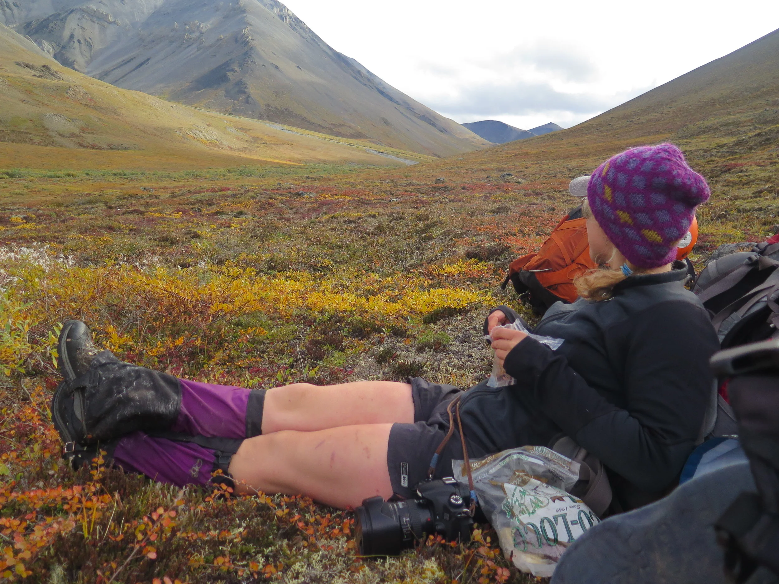
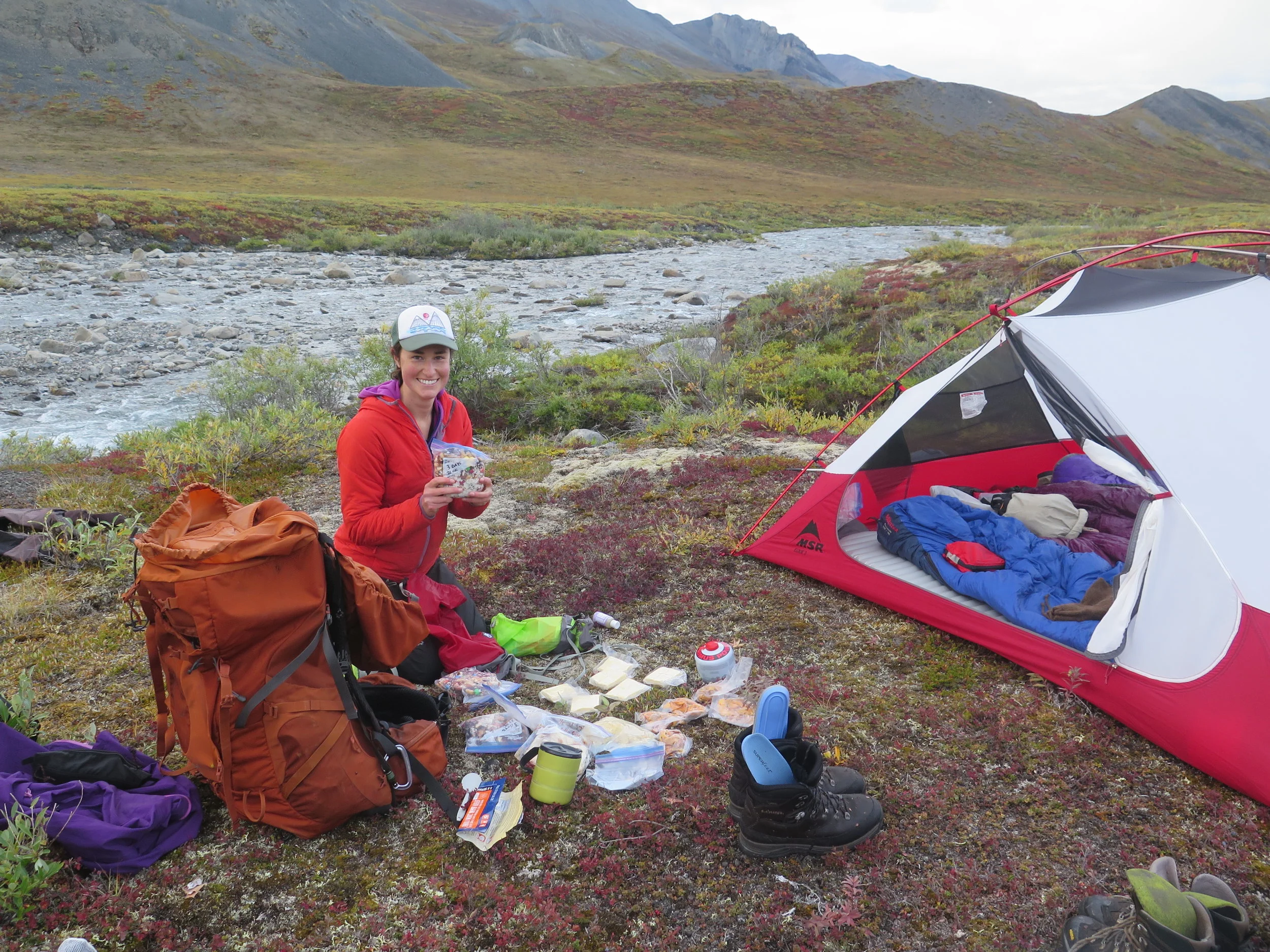
Just for fun, if you made it this far, I'll leave you with some scenic snacking photos. We went to a really beautiful place and we ate SO MANY snacks. :)